
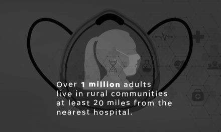
Animated COVID map made with GeoLayers 3
I built this animated map for a quick turn story for USA Today and AZCentral story about how rural communities could be extra vulnerable to Cover 19 due to the lack of hospitals and long distances people might have to drive to get to a hospital. Over 1 million adults live in rural communities at least 20 miles from the nearest hospital.
I built this map animation using GeoLayers 3. GeoLayers is one of the most powerful plugins for After Effects. With a map subscription you are able to pull map data from a bunch of different APIs, have total control over map styling, create 3d topography made from hight maps and animate cameras.
I found the plugin to have a steep learning curve but once you get the hang of it you can get some great results. This was made in a few hours for a deadline story.


